Characteristics:
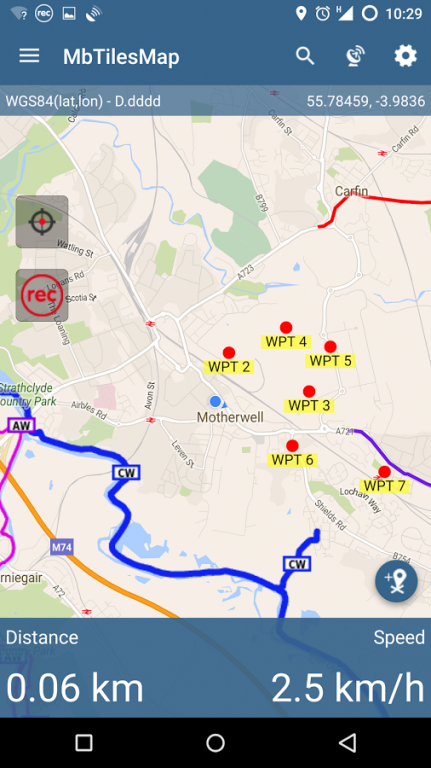
- Display mbtiles from Maps folder as Google Maps Overlays
- Record GPS Tracks
- Tracks Managements and export option to KML, GPX and GeoJSON, ArcJSON
- Waypoints Management - add waypoints at any time, add photographs, group them in categories and share single waypoint or whole category as KML or GeoJSON files.
- Support for different coordinates format
- Possibility to import exported GPX to third party app like Runkeeper.
- Quick Measurement tool - useful if you need to check distances on the map.
This application is meant to be very simple and quick to use. It's new on market and is under active support and new ideas or suggestions are very welcome. If you are looking for more advanced products please check out MapIt - GIS Data Collector or MapPad app.
We do not host MbTiles Map - Hiking & Biking on our servers. We did not scan it for viruses, adware, spyware or other type of malware. This app is hosted by Galad and passed their terms and conditions to be listed there. We recommend caution when installing it.
The APK Download link for MbTiles Map - Hiking & Biking is provided to you by apps112.com without any warranties, representations or guarantees of any kind, so access it at your own risk.
If you have questions regarding this particular app contact the publisher directly. For questions about the functionalities of apps112.com contact us.

|
| ||||
| Downloads: 32 | ||||
| Updated At: 2024-04-23 10:06:28 | ||||
| Publisher: Andrzej Bieniek | ||||
| Operating System: Android | ||||
| License Type: Free |